


|
|
|---|
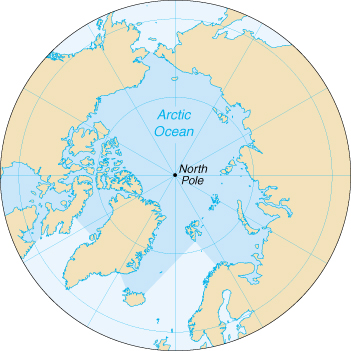
| Arctic Ocean |
 |
| Geography |
Location: body of water mostly north of the Arctic Circle
Geographic coordinates: 90 00 N, 0 00 E
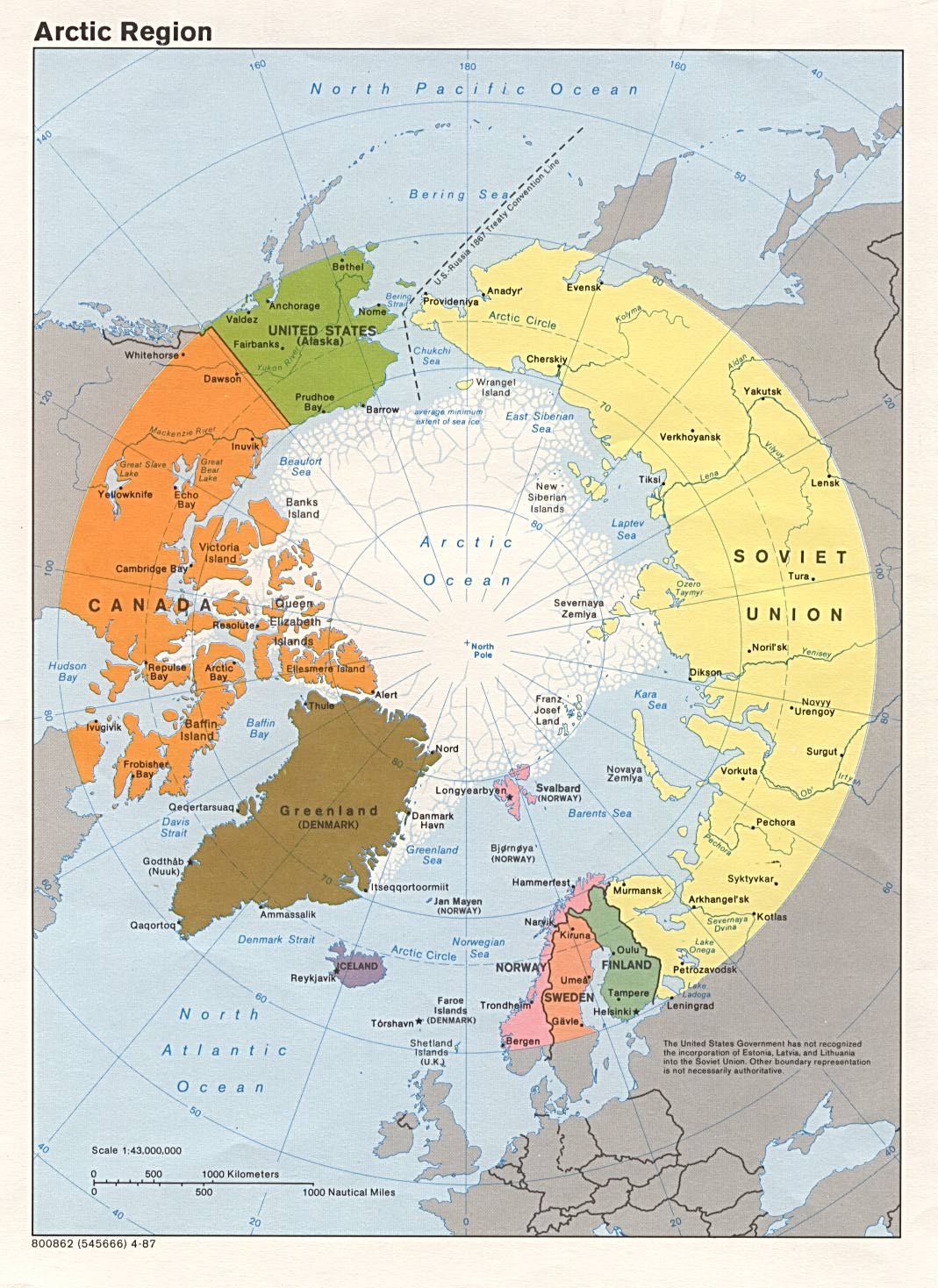
Map references: Arctic Region
Area:
total:
14.056 million sq km
note:
includes Baffin Bay, Barents Sea, Beaufort Sea, Chukchi Sea, East Siberian
Sea, Greenland Sea, Hudson Bay, Hudson Strait, Kara Sea, Laptev Sea,
Northwest Passage, and other tributary water bodies
Area-comparative: slightly less than 1.5 times the size of the US; smallest of the world's four oceans (after Pacific Ocean, Atlantic Ocean, and Indian Ocean)
Coastline: 45,389 km
Climate: polar climate characterized by persistent cold and relatively narrow annual temperature ranges; winters characterized by continuous darkness, cold and stable weather conditions, and clear skies; summers characterized by continuous daylight, damp and foggy weather, and weak cyclones with rain or snow
Terrain: central surface covered by a perennial drifting polar icepack that averages about 3 meters in thickness, although pressure ridges may be three times that size; clockwise drift pattern in the Beaufort Gyral Stream, but nearly straight-line movement from the New Siberian Islands (Russia) to Denmark Strait (between Greenland and Iceland); the icepack is surrounded by open seas during the summer, but more than doubles in size during the winter and extends to the encircling landmasses; the ocean floor is about 50% continental shelf (highest percentage of any ocean) with the remainder a central basin interrupted by three submarine ridges (Alpha Cordillera, Nansen Cordillera, and Lomonsov Ridge)
Elevation extremes:
lowest point:
Fram Basin -4,665 m
highest point:
sea level 0 m
Natural resources: sand and gravel aggregates, placer deposits, polymetallic nodules, oil and gas fields, fish, marine mammals (seals and whales)
Natural hazards: ice islands occasionally break away from northern Ellesmere Island; icebergs calved from glaciers in western Greenland and extreme northeastern Canada; permafrost in islands; virtually icelocked from October to June; ships subject to superstructure icing from October to May
Environment-current issues: endangered marine species include walruses and whales; fragile ecosystem slow to change and slow to recover from disruptions or damage
Environment-international agreements:
party to:
none of the selected agreements
signed, but not ratified:
none of the selected agreements
Geography-note: major chokepoint is the southern Chukchi Sea (northern access to the Pacific Ocean via the Bering Strait); strategic location between North America and Russia; shortest marine link between the extremes of eastern and western Russia; floating research stations operated by the US and Russia; maximum snow cover in March or April about 20 to 50 centimeters over the frozen ocean; snow cover lasts about 10 months
| Government |
Data code: none; the US Government has not approved a standard for hydrographic codes - see the Cross-Reference List of Hydrographic Data Codes appendix
| Economy |
Economy-overview: Economic activity is limited to the exploitation of natural resources, including petroleum, natural gas, fish, and seals.
| Communications |
Telephone system:
international:
no submarine cables
| Transportation |
Ports and harbors: Churchill (Canada), Murmansk (Russia), Prudhoe Bay (US)
Transportation-note: sparse network of air, ocean, river, and land routes; the Northwest Passage (North America) and Northern Sea Route (Eurasia) are important seasonal waterways
| Transnational Issues |
Disputes-international: some maritime disputes (see littoral states); Svalbard is the focus of a maritime boundary dispute between Norway and Russia
|
|
|---|